Planning service area locations
This page is about how motorway service area locations are planned in general. For specific route history guides, see Unbuilt Services. For council planning departments, see Planning Authorities.

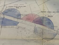
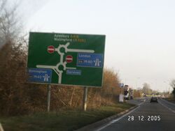
Some of the most famous (and indeed infamous) motorway service areas in the country are positioned at difficult roundabouts. The operator normally gets the blame for this, and occasionally they deserve it, but most of the time they are fairly innocent.
Until 1992, motorway service area locations were chosen by the government. There was no rule that they had to be built online, but they usually were. They were planned at intervals roughly every 15 miles (generally skipping every other service area until traffic levels picked up). The exact distance between motorway service areas varied, originally as low as 12 miles, changing to a "case-by-case" basis of around 28 miles in 1979.
Initially, the distance between service areas was enforced fairly rigidly. As time went on, factors such as environmental concerns, the need for a large plot of land, and political objections all began to take priority. Motorways were increasingly opening around the rural-urban fringe where there were frequent junctions and plenty of irate neighbours. In addition, developers were falling out of love with the whole idea, so the government tried to keep them sweet by choosing profitable locations.
These factors all combined to cause many motorways like the M25 and M42 to open without enough service areas, and to cause service areas to be proposed in totally unsuitable locations such as Gordano, South Mimms, Tamworth and Birchanger Green, which are all offline examples. At Cherwell Valley, the local council had been pushing for that location for 10 years before it was built, as they knew it involved the least work.
Highway engineers genuinely seemed to believe that if they had several major roads, a few local turnings and a service area all arranged around the same roundabout, it would keep everybody happy by avoiding the need for multiple buildings or big, expensive flyovers. Which it did, for a few years, until these roundabouts became congested and they have been a nightmare ever since.
The Current System

See also: Ongoing service area plans
By 1992, developers were totally responsible for planning service area locations. Developers favoured smaller, profitable locations at existing junctions, as did the planning authorities. The new policy was supposed to encourage more frequent, smaller service areas. It also allowed the government to distance themselves from the whole process, which they were particularly keen to do after becoming involved in so many controversial service area proposals, with Clacket Lane causing the most trouble.
Operators welcomed the freedom, but suggested that the process would now take longer, as the Department of Transport wouldn't be able to endorse any new proposals. This meant that while there was an increase in new proposals, there wasn't much more diversity, as you needed money and experience to be able to see the planning process through.
A second problem soon emerged with the new system. Developers were always going to prioritise the locations which would make the most money, and these would be places with lots of cars. By the 2020s, coffee shops for leisure travellers became a major income stream. Facilities for HGVs were often an afterthought and reduced to the bare minimum to see the project approved.
As the planning system is the main barrier to new service areas being built, authorities can strongly influence where they are built using their local plan. This can be generic (by encouraging retail activity by a bypass) or specific (by allowing for a service area on a particular plot of land). This doesn't ensure that one will be built, but it can encourage developers by assuring them that they will receive a more favourable planning journey. This tends to only happen where there is clearly pressure for a new service area; in most cases, a local authority is more likely to argue that any new service area should be built outside their boundary.
The new regulations specified an absolute minimum distance of 15 miles between service areas. That was abolished in 2013, as a new government encouraged even more competition. Two rival service stations can now be built opposite each other, as will happen at Bridgwater. As of 2022, motorways are expected to have facilities for HGVs at least every 14 miles, and facilities for cars at least every 28 miles; a new clause also says that there "may be a role" for highway authorities in providing these facilities.
On A-roads, planning service areas has always been down to the private sector, with no joined-up planning process. As of 2022, non-motorway trunk roads are expected to have facilities for HGVs less than 20 minutes apart, and facilities for cars at least every 30 minutes.
In Ireland, online service areas are planned by the state while offline service areas are planned by the private sector. The government tried to build its own network of online service areas, but in many places they were overtaken by the private sector who got there first.
Selection Criteria
In 1990, England's Department of Transport outlined the criteria they had been using when searching for a suitable site for a motorway service area:
- it must be cost effective to develop, from acquiring the land, through to levelling the land and connecting it to the motorway
- it must be easily accessible from the motorway (note that the DfT's idea of "easily accessible" may be a little more vague than some motorists'!)
- it must be suitable from a traffic and road safety point of view
- it must be big enough to comfortably accommodate all the facilities required for the next 30 years
- it should comply with national, regional and local planning policies
- it should minimise intrusion on residential and sensitive areas
- it should be beneficial to local employment
- it should be commercially viable to operate
You can understand how it became difficult to apply all these rules to many of Britain's crowded motorways. These days, most of these issues are to be scrutinised during the planning process.
Since 2008, the government has made it clear that they prefer service areas which are built away from a junction, and in 2022 they re-worded this to say that a site at a junction must be given preference, if one is available. The problem is that there is no comeback if a developer claims that building between junctions is impossible: they could be thinking of many factors, including construction costs, running costs, catchment area and the increasing safety requirements when building new junctions on Britain's increasingly busy and constrained motorways.
Historic Failures
Contrary to popular belief, there is zero evidence of there having been a goal to build each service area as close to a motorway junction as possible. Despite this, it is true that almost all of the early motorway service areas were built very close to a motorway junction, which would go on to cause decades of safety issues. A 2022 study found that 40% of England's between-junction motorway service areas were below the modern requirement of being 2km (1.2 miles) from a junction, and 30% were less than 1km (0.6 mile) from one.
By 1964 at the latest, it had been written in black and white that no motorway service area was to be built within one mile of a junction. As always with roads policy, exceptions were made. Where two different possible sites were being examined, the one that was closer to a junction would be seen as a negative, and not the objective.
The only plausible explanation is that other factors, like the distance between service areas and the suitability of the land, always took priority. The distance between exits, while it was known to be a problem, wasn't seen as a major issue in the 1960s, as can be seen in many of the road layouts that were built at the time.
Motorways With No Services

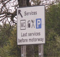
Once the motorway service area planning system had been separated from the main motorway planning system, it was inevitable that issues would soon arise. Government guidance has generally been to keep service areas no more than 28 miles apart on any motorway route, but there have been some notable exceptions:
- There was a famous sign on the M4 westbound approaching Heston, which said "last services for 106 m". This was measured to Aust, but the motorway wasn't complete at the time. It was later changed to 82 miles, and remained that way for a while as there was a debate about what to do in the Reading area.
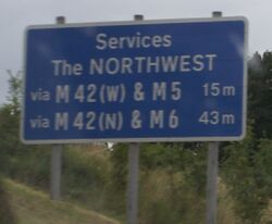
- The M42 acts as a link road between several key motorways: the M5, M6, M40 and effectively the M1. While some service areas were eventually provided on the road, the core section between the M40 and M6 remains without any. This creates a 48 mile gap between Warwick and Hilton Park - though there is an alternative route with more service areas. Service areas in the Solihull area were debated before the road was built and continue to be debated to this day.
- The M25 was a rushed job and in many respects it wasn't well planned. When it was completed in 1986, it had just one half-built service area covering the whole 118 mile route. The gap was never truly plugged until Cobham opened in 2012.
- The M40 was completed in 1991. Linking the M25 and the M42, it combined both of the problems above into one mega-problem. It was now possible to drive from Maidstone to Telford, a journey of about 200 miles, without passing any service areas at all. This issue received political attention, as it was used to justify deregulating the industry. Cherwell Valley opened in 1994, with Beaconsfield filling the final gap on the M40 in 2009.
- The A1(M) through North Yorkshire was the only significant length of motorway to open since the government stopped planning motorway service areas altogether, with the first phase having opened in 2009. As it was an upgrade to the existing A1, its construction involved actively taking away existing facilities. Local objections mean the planning system has been slow to replace them: it is 63 miles from Barnsdale Bar to Scotch Corner, with only Wetherby, and Leeming Bar and Ferrybridge (both of which require a significant diversion) in between. Wetherby is extremely well utilised, suggesting there is demand for more.
- The North West of England has a very dense network of motorways; much more dense than anywhere else in England. As a result, it's possible to work out a few routes (usually not sensible ones) that will cause you to avoid all of the service areas. This normally involves using the M62 between J10 and J12. Warrington will address this.
In summary:
- The biggest gap between two motorway service areas via a reasonable motorway route is 63 miles, from Toddington on the M1 to Reading on the M4. Warwick to Telford is shorter by a matter of yards.
- The biggest gap between two service areas on the same motorway is Cobham to South Mimms on the M25, which is 44 miles.
- The longest logical motorway journey you can do before reaching a service area is by joining the A329(M) at Reading, and heading for the M1 in Bedfordshire, where the first service area is at Toddington - 58 miles along.
- The longest end-to-end, logical motorway journey you can make without passing any service areas at all is from the M58 near Bootle to the M67 near Mottram, which would be 52 miles.
- The longest motorway without any service areas at all is the M60, which is 36 miles long. As it's a ring road, you're unlikely to go the whole length, but you could keep going round to your heart's content.
A-roads

There are no figures for the A-road network.
The general guidance was that rural A-roads should have service areas every 12-25 miles. The mighty A9 in Scotland goes an impressive 106 miles between official service stations and is probably the winner in every category, but it does pass numerous villages and local facilities along the way and it's probably misleading to totally ignore those.
You could achieve a high figure by looking at an A-road which has been replaced by a motorway. The A38 has service areas in Gloucestershire and Derbyshire, and runs for about 98 miles in between them, but nobody sensible would take that route when you have the motorways instead.
There are plans to turn the A66 into a dual carriageway between the A1 and the M6. Assuming this happens (and assuming no new service areas open) this would probably create the longest high-speed dual carriageway with no service areas, at about 60 miles. We are open to suggestions as to what the current holder of this title may be.
Ireland
Ireland's entire motorway network had no official service areas until 2010. Between the M8 being finished in May 2010 and the service areas opening in September, it was possible to drive from Dundalk to Cork: 336 km (208 miles), entirely by motorway, without any service areas. This was leagues ahead of anything England has ever had.
The longest motorway with no service areas was the M7: 195 km (121 miles).
Currently, the longest motorway journey in Ireland with no service areas involves using both the M17 and the M18 from Tuam to Shannon, totalling 94 km (58 miles). If you follow the N18 dual carriageway and the M7 to the nearest official service area at Birdhill, that becomes 138 km (86 miles).
Closest Services
Lymm and Knutsford on the M6, which are 5.1 miles apart (or 6.3 including the junction). If you disqualify Lymm for technically being a truckstop, then the answer will be at the far end of the M4: Pont Abraham and Swansea are 6.2 miles apart (or 6.7 including the roundabouts).
There are many examples of signposted A-road service areas which are only one mile apart, such as Solstice and Countess on the A303, or Stansted and Birchanger Green on the A120. The exact league table would depend on how you measure each roundabout.
There is one more example, but it's a bit odd. There are service areas at M4 J23A (Magor) and M4 J23 (Severn View). The two exits are precisely 1 mile apart. This means the moment you leave Magor, you're met with signs for Severn View. However Severn View is actually located far down another motorway, so the two are actually 10 miles apart, and most road signs do make that clear.
The closest online service area to a junction is Washington northbound, where the entry to the service area begins immediately after the merge from J64. This is different to the southbound side, where the two actually cross over each other.
Awkward To Get To
See also: Longest Drives
Given the number of comments we receive about service stations that take too long to get to, we decided to find the worst offenders:
- Accessing Ferrybridge from the A1 northbound will add 3.6 miles to your journey.
- Donington is 2.4 miles away from the M1, and the journey will take you through six traffic light junctions.
- Exeter is right next to the M5, but getting to the car park from the M5 southbound will take you through eight sets of traffic lights.
- If you count the signs for Severn View on the M4, that one is 9.7 miles away.
Full calculations are available at Longest Drives.