Unbuilt Services On The M25
For a list of current service areas on the M25, see Services on the M25.
If you're ever in the unlikely position where you get to design your own motorway, our advice would be this: study the M25 closely, and then do the exact opposite.
Whatever impact the M25 has on your life, it's fair to say that it was not planned properly. Some readers will already know the history which is well-documented on Roads.org.uk, but in simple terms the M25 is actually two different motorways which were unceremoniously glued together part-way through the construction process.
Yes, the northern and eastern parts of the M25 were actually designed to be a separate motorway, the M16. The M16 would have continued on its own route around South London, and this was supposed to help the M25, rather than depend on it. The two projects were officially merged in 1976.
A Difficult Job
Often in this section of the website we talk about "the original plan" for service stations. The M25 didn't have an original plan because, even when work had begun on the motorway, it still wasn't clear what route the finished road would be taking. To try to get round this, planners started at M25 J5, on the basis that this would be one of the first sections of the road to open, and they then made their way around clockwise in the hope that by the time they made it to Hertfordshire, it would be clear what the route of the road was.
That didn't work. On this page when we talk about "the original plan", we will normally refer to the aspiration for new service stations when the M25 was finished in 1986.
The changing route wasn't the only challenge when it came to service stations. Motorway service area planning generally worked by measuring the distance from the previous service areas, but with the M25 linking a long list of motorways and major roads, that model didn't work. There weren't really any comparable examples of this to take inspiration from. Many who were involved in the process suggested that most traffic on the M25 wouldn't be on it long enough to use a service area, and instead they should be provided on nearby motorways, such as at Trumps Green on the M3.
Then there's the route that the M25 takes as it snakes its way around the leafy fringes of Greater London and its satellite towns. This causes two issues: firstly the area is mostly green belt and has many neighbours who wouldn't take kindly to a new service station, and secondly the M25 has very frequent exits which leave no space for a new service station. This is especially true for the parts which were designed to be M25 rather than M16; the M25 was to be the leafy motorway.
These frequent junctions, built to the M25's trademark low budget, were all built with a low capacity that means the addition of a service area would always be unwelcome. South Mimms, in particular, is notorious for the very busy roundabout which guards the entrance to the service area.
All-in-all, it wasn't an easy job.
The First Effort
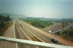
As mentioned above, planning for service stations on the M25 started at J5 and made its way around clockwise. This appeared to have originated with a joint study from Kent and Surrey County Councils, who measured up the M20 and along the M25.
As a result, three potential service areas were identified in 1975: Chevening, Leatherhead and Poyle. The Department of Transport became involved in the study and intended to continue it around the M25, but both Poyle and Chevening had planning issues which threw the whole thing into disarray.
There were two schools of thought as to how it should work. Some argued that a smaller service area would be less likely to be drowned out by objections, while others said there was no point building anything that was going to be overloaded on day one.
For example, Gatton Bottom (between J7 and J8) was identified as an ideal infill site between Chevening and Poyle, but was immediately called a "non starter" because of the objections it would attract. This length of road was filled with rejected back-up sites.
Chevening
Chevening services (sometimes called 'Sevenoaks') was planned for the south-east corner of M25 J5, and is perhaps one of the best examples of a "lucky escape" on the UK road network.
As far as the Department for the Environment were concerned, Chevening services was definitely going to be built. It was chosen because it was a single site which could serve several routes at once, which would have kept costs down. Its location was measured from Detling on the M20.
To understand why it wasn't built, first you need to understand the history. What's now the M25 between J4 and J5 was originally built as the A21 Sevenoaks Bypass. You can see on a map how that road flows into the flyover and the main A21 beyond there. The plan was that the M25 would approach from the west, and continue east along the road that's now called M26.
Where the two roads crossed, the plan was to have a large roundabout. Engineers for the M25 loved a large roundabout and large roundabouts can be seen all the way along the motorway. Here, access would also have been provided to Chipstead Road and Chevening services. It was expected to open in 1976. You can see the exact arrangement intended, in the context of what the M25 and A21 would have looked like, on SABRE Maps.
The planned roundabout was eventually cancelled, not because of traffic issues, but because it strayed into Chevening Estate, where land could only be sold with the Prime Minister's approval. To reduce bureaucracy, a bespoke junction arrangement was created which steered clear of Chevening and the two villages. This new road layout (which is what was eventually built) left no space for access to a service area, so the service station plan was cancelled. This decision was made before the route of the M25 was changed.
Fortunately for as long as Chevening services had been on the agenda, a site near Westham (also called Titsey Woods, now called Clacket Lane) was identified as an alternative. That was eventually built, after its own saga.
With hindsight, the land allocated for Chevening services was a little too small, and its scenic backdrop meant there were likely to be objections from Chipstead residents - who had already complained about the new motorway. There was also the small matter that a roundabout would not have worked here.
Poyle
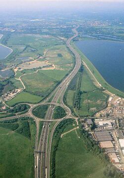
Poyle services was planned for the south-western side of M25 J14, very close to Heathrow Airport. It was widely known as Colnbrook services, and sometimes called Stanwell Moor services.
Building service areas at junctions was a popular option for the Department because these kept costs down. On this part of the M25 there was the bigger issue that the junctions were too close together to build any more exits between them; Poyle was described as "the only suitable location".
Poyle was the included in the M25's public inquiry and scheduled to be included as part of the motorway's Compulsory Purchase Order in 1977. A scheduled opening date of 1981 was given, and a 1978 report said it would be open by 1982, subject to an inquiry.
The inquiry concluded that insufficient evidence had been provided to show that Poyle was the best option. In addition, complaints had been made that it would have cut off access to a new local park. Poyle was now postponed.
Poyle had been allocated a 32-acre site, neatly tucked between the motorway and the reservoir.
The 1999 public inquiry briefly remarked that this would not be a suitable site for a service area, even though one was no longer planned here anyway.
Leatherhead
Between Chevening and Poyle was a planned infill service area at Leatherhead, which would only be built when the other two reached full capacity.
A site was identified at Rawhurst Farm, but the planned route of the M25 was changed to run north of Leatherhead, rather than to the south. Some had questioned the need for another service area, but the Department for the Environment insisted.
They considered several more options, including near Walton-on-the-Hill at Frith Park. This was described as "an attractive place to stop", with one civil servant going as far to say that "Surrey would be proud to offer this to the motorway traveller". Another near Downside at Bookham Road/Poynters Farm was named, as well as Addlestone Combelands. New Haw and Rye Wood were named as possible locations too.
Surrey County Council were opposed to building any service area in the Leatherhead area, but it was the Department for the Environment's decision to make. Ultimately no decision was made, and with the other two still up in the air, it wasn't worth upsetting the locals by planning a future service area here.
Although this section only covers a third of the M25, the fact three possible service areas had already been identified gives some indication as to how many service areas planners were expecting the M25 to open with.
The Thatcher Plan
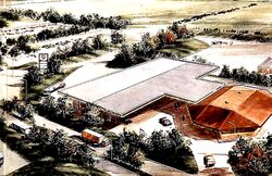
Margaret Thatcher wasn't really involved in the planning of the M25, but as she is famously remembered for attending the motorway's official opening ceremony, we're going to use her to describe the plan at this time.
In truth, the fresh start was prompted by the Prior Report of 1978. This threw away the 12 mile rule that service station planners had been generally sticking to, and instead invited planners to treat every road on a "case-by-case basis". It also encouraged the idea of saving money placing service areas at junctions, and considered other ways of making service stations more profitable to run.
Chiltern planning committee chairman Cllr Peter Lole, 1983
Meanwhile, pressure was mounting as parts of the M25 were opening and motorists were commenting on the lack of facilities. In 1983 the government began a consultation titled "Motorway service areas for the M25". They entered discussions with the local authorities, including Chiltern District Council, which raised alarm in the area.
A number of private developers tried to get in first by planning their own service areas, but the Department for the Environment were clear that they had to at least wait for the outcome of the consultation. The consultation was considered in a study which was published in 1984, but it became really well-known after the motorway officially opened in 1986.
The plan was to only have four service areas:
- Clacket Lane (J5-6) - the immediate alternative to Chevening, confirmed in 1976, set to open in 1982 but stuck in planning issues until much later
- Iver (J15-16) - a recent addition, and although it was a serious proposal, little progress had been made at the time
- South Mimms (J23) - re-using a petrol station that already existed, and was identified in 1975 as being a quick solution. Indeed Thatcher personally opened the finished project.
- Thurrock (J30/31) - confirmed 1985, opened to bids 1986, but hit by technical difficulties
Many at the Department had previously said that more than four service areas were needed. Previous policy would have recommended up to eight service areas. Now, four service areas was described as "an essential minimum and a desirable maximum". The study now reckoned that these four would be able to cater for traffic levels until 2015, after which more would be needed.
All four would be required to be landscaped "to a very high standard".
For the first few months after the M25 opened, South Mimms wasn't ready, so there were no service areas, and signs all along the new motorway said "No services on M25". It was a situation Egon Ronay called "a scandal". Three of those did eventually open: industrial Thurrock was hampered by technical issues, while Clacket Lane had a long-running planning dispute.
Predicting problems at Clacket Lane, the study considered 'Pendell Wood' (to be attached to the M23 interchange) and an option to bring back Chevening, by having traffic enter and exit from the A21, having to rejoin the M25 by turning around at the main Sevenoaks exit. Tandridge District Council put forward an insane suggestion of building it in the middle of the M23 at Hooley: this was seriously considered, but engineers concluded it would have been dangerous to get to and unlikely to be popular. The study concluded that the controversial Clacket Lane option was the least bad.
Iver
This is the original Iver plan. For the ongoing one, see Colne Valley.
Of those four planned service areas, three of them were built and can be seen today. So what became of Iver?
Our records for Iver services go back to 1982. This would match up with Poyle becoming unavailable, and confusion over the planned route of the motorway here.
Iver had the special quality that it would have been connected to the railway station, and would have operated a park and ride service. It was expected to be opened to bids in 1986, and open to the public in 1991. Instead a public inquiry was held in 1986, causing a delay.
Proposals to widen the M25 caused the service area planned at Iver to be postponed. It had been acknowledged that the environment here would have required a challenging layout, probably with one amenity building and flyovers for traffic on the other side. By 1989, it was reported that the Iver plan had been "scrapped", and that the Department of Transport were beginning a new search, focusing on the Chertsey area.
When the private sector took over service area planning in 1992, several possible sites were proposed near here.
M16 Study
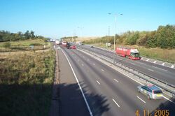
This page so far would have you believe that absolutely no progress on the northern and eastern sections of the M25 was made until it was nearly ready to open. That's not quite true.
Preliminary studies did briefly consider where service areas could be built on the motorway which was intended to be called the M16. These mostly came from Essex County Council, who would need to be consulted on any service area plan, while the Department for the Environment tended not to want to get involved. They did keep tabs on their ideas, though.
The service areas which this picked up were:
- South Mimms (now M25 J23): as mentioned above, this was already built, and the Department realised that could be a quick way of ensuring something was open. Strictly speaking it would have been just off the M16 route.
- Hill Hall (now M25 J27-28): this seemed to be a popular location in the north-east corner.
- Brentwood (now M25 J28): this was only briefly mentioned. They have meant the roundabout that would have linked the M16 and the M12, in which case it would have been withdrawn once the M12 was given its own service area plan.
- Mar Dyke (now M25 J30): the north-west corner was Essex County Council's favourite site.
- Pedham Place (now M25 J3): this would repeatedly come up, as it would serve the M20 as well as the M16.
It seems that the Department for the Environment were initially keen on Hill Hall and Pedham Place, at least as recently as 1977. They moved their attention to Thurrock when the landowner there was keen to sell. There was also talk about building immediately south of the Dartford Crossing, which appeared on some late 1970s maps as "Dartford services".
Note that Pedham Place (at M25 J3) would not have been close to the site we previously mentioned at Chevening (at M25 J5). That's because at the time these two were expected to be on different motorways, which wouldn't have linked up like they do now.
After Opening
There is very little evidence of Iver being carried forwards after the motorway opened. Plans for the M40 in 1990 said that the M25 would "probably" have a service area "somewhere" between J15 and J16, with no commitment to Iver specifically.
When responsibility for planning service areas was passed to the private sector in 1992, the Department of Transport said they had completed "preliminary work" on a service area for the M25's western section, but didn't provide any more detail than that.
The national Policy Statement of 1998 had a whole section about how the M25 was a difficult road for planning applications, but added that enquiries were ongoing. This would lead to the 1999 public inquiry, which was quashed by the High Court and revisited in 2002.
When the M40 was finished in 1991, this would combine with the M25 to create a 236 mile motorway route with no service areas. This would be a major source of embarrassment for the government, and the main reason why service station planning was passed to the private sector. Even when Clacket Lane opened in 1993 and Cobham opened in 2012, there would still be a very large gap.
A statement from Highways England in 2016 took the view that a service area should be built on the M25 between J15 and J16. Their successor met with developers in February 2022, to encourage them to build near M25 J27.
That this part of the M25 would be the most difficult to provide facilities for is not a total surprise. As we said at the start, the southern and western parts of the modern M25 were supposed to be further from Central London, taking a leisurely route around the suburbs where additional construction is not looked upon kindly. It is also the busiest part of the M25, so it was likely to be the first to experience parking issues.
Private Proposals
Since 1992, developers have been solely responsible for coming up with their own proposals for new motorway services. This led to an increase in proposals, but they are normally clustered around the same area and most are quickly ruled out.
Some of the new motorway services once planned for the M25 we have uncovered include:
| Place | Location | Proposed | Resolved | Outcome | Notes |
|---|---|---|---|---|---|
| Brent Farm | J4 (east side) | 1983 | 1983 | Refused on appeal. | Refused because the M25 study was ongoing. |
| Dartford | J1A | 1984 | 1997 | Withdrawn. | Planned Blue Circle Dartford Estates Ltd. There were public toilets advertised at this exit for many years. |
| Godstone | J6 (north-east corner) | 198x | 198x | Refused. | Planned by Esso as an alternative to Clacket Lane. Accessed from roundabout on A22. |
| Kingswood | J8 (north-west corner) | 1987 | 1987 | Refused. | Planned by Esso. Refused because it's green belt land, would cause traffic issues, and contrary to the DoT's plan. |
| Waltham Abbey (Southend Farm) | J26 (north-east corner) | 1993 | 1996 | Refused on appeal. | Planned by Laser Properties Ltd over 44 acres. Refused because it was green belt land. |
| Hill Hall | J27-28 (Mount Road) | 1993 | 1996 | Refused on appeal. | Planned by Chantry Property Development & J Rowland. |
| Waltham Abbey | J26 (north-west corner) | 1993 | 1996 | Refused on appeal. | Planned by J F Oram & Extra. |
| Chertsey (Great Grove Farm) | J11 | 1994 | unknown | Planned by Extra. | |
| Theydon Mount (Colemans Farm) | J27-28 (Mount Road) | 1994 | 1996 | Refused on appeal. | Two options planned by Argent Group & Chantry Prop and Dashswivel Limited. |
| Woodlands Park | J15-16 (Palmers Moor) | 1994 | 1999 | Refused. | Planned by Cape Plc & Corporate Land Ltd. Would have been built to the east of the motorway, with a new dual carriageway flyover which would have left space for the M25 to be widened. Also considered building at Iver station, Poyle and Palmers Moor. Taken to 1999 public inquiry. Refused because it's green belt land, and the M25 has a poor safety record. |
| Chertsey (Simplemarsh Farm) | J11 | 1994 | 1999 | Refused. | Planned by Hadmere Ltd and Totalfina. Refused at 1999 public inquiry for being on green belt land, on road safety grounds and due to traffic issues. |
| Cobham (New Barn Farm) | J9-10 | 1995 | 2012 | Built. | Subject to 1999 and 2002 public inquiry. |
| Warren Farm | J16-17 (Denham Lane) | 1996 | 1999 | Refused. | Planned by Lawlor Land Plc and Totalfina. Refused because it's green belt land within Colne Valley Park. One of the objectors was Iron Maiden's Adrian Smith. |
| Elk Meadows | J15-16 (Slough Road) | 1996 | 1999 | Refused. | Planned by Caswell Contracting (U.K.) Ltd and Cape Plc. Taken to 1999 appeal. Refused because it's too close to the M40 exit. |
| Kings Langley | J20 (south-west corner) | 2018 | 2021 | Refused. | Planned by Moto. Accessed from new roundabout on the A41. Would have been three storey to take advantage of the hill. Opposed by Extra and thousands of residents. |
| Warren Farm (Chalfont St Peter) | J16-17 | 2018 | 2021 | Refused on appeal. | Planned by Extra. Opposed by SENSE4CSP. |
| Chiltern Chalfont | J16-17 | 2022 | 2023 | Refused. | Planned by Extra. Opposite their Warren Farm site. Refused because the nearby Colne Valley plan was said to be less destructive. |
| Colne Valley | J15-16 (Slough Road) | 2020 | ongoing | Approved. | Unusual project where Buckinghamshire County Council will lease land to Welcome Break, raising income for the council. |
| Brentwood | J27-28 (Chequers Road) | 2024 | ongoing | Proposed by Moto. | |
| Roding Valley | J27-28 (Muthering Lane) | 2024 | ongoing | Proposed by Welcome Break. |