Planning service area locations

Some of the most famous (and indeed infamous) motorway services in the country are positioned at difficult roundabouts. The operator normally gets the blame for this, and occasionally they deserve it, but most of the time they are innocent.
Until 1992, motorway service area locations were chosen by the government. There was no rule that they had to be built online, but they usually were. They were planned at intervals roughly every 15 miles (skipping every other service area if it was a quiet road). The precise location would be studied in detail, considering how much disturbance would be caused and how pleasant a site it would make.
As services became larger and motorways became more contentious, planning services became more of an art. Motorways were opening around the rural-urban fringe where there were frequent junctions and plenty of irate neighbours. Local councils became much more obstructive. In addition, developers were falling out of love with the whole idea, so the government tried to keep them sweet by choosing profitable locations. These factors all combined to cause many motorways like the M25 and M42 to open without enough services, and to cause services to be proposed in totally unsuitable locations such as Gordano, South Mimms, Tamworth and Birchanger Green, which are all offline services. At Cherwell Valley, the local council had been pushing for that location for 10 years before it was built, as they knew it involved the least work.
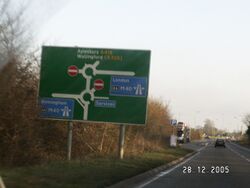
Highway engineers genuinely seemed to believe that if they had several major roads, a few local turnings and a service area all arranged around the same roundabout, it would keep everybody happy by avoiding the need for multiple buildings or big, expensive flyovers. Which it did, for a few years, until these roundabouts became congested and have been a nightmare ever since.
By 1992, developers were totally responsible for planning service area locations. Developers favoured smaller, profitable locations at existing junctions, as did the planning authorities. The new policy was supposed to encourage more frequent, smaller services. A minimum distance of 15 miles was specified.
In 2013, the absolute minimum distance was abolished. Two rival service stations can in theory now be built opposite each other, if they can both get planning approval.
On A-roads, planning services has always been down to the private sector, with no joined-up planning process.
In Ireland, online services are planned by the state while offline services are planned by the private sector.
Where Planning Hasn't Worked - Motorways With No Services

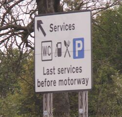
Over time, the planning system has resulted in some significant lengths of motorway having no services. Government guidance has generally been to keep services no more than 28 miles apart on any motorway route, but there have been some notable exceptions:
- There was a famous sign on the M4 westbound approaching Heston, which said "last services for 106 m". This was measured to Aust, but the motorway wasn't complete at the time. It was later changed to 82 miles, and remained that way for a while as there was a debate about what to do in the Reading area.
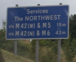
- The M42 acts as a link road between several key motorways: the M5, M6, M40 and ultimately the M1. While some services were eventually provided on the road, the core section between the M40 and M6 remains without any. This creates a 48 mile gap between Warwick and Hilton Park - though there is an alternative route with more services. Services in the Solihull area were debated before the road was built and continue to be debated to this day.
- When the M25 was a rushed job and in many respects it wasn't well planned. When it was completed in 1986, it had just one half-built service area covering the whole 118 mile route. The gap was never truly plugged until Cobham opened in 2012.
- The M40 was completed in 1991. Linking the M25 and the M42, it combined both of the problems above into one mega-problem. It was now possible to drive from Maidstone to Telford, a journey of about 200 miles, without passing any services at all. This issue received political attention, as it was used to justify deregulating the industry. Cherwell Valley opened in 1994, with Beaconsfield filling the final gap on the M40 in 2009.
- The A1(M) through North Yorkshire is the only significant length of motorway to open since the government stopped planning motorway services, with the first phase opening in 2009. As it is an upgrade to the existing A1, its construction involved actively taking away existing facilities. Local objections mean the planning system has been slow to replace them: it is 63 miles from Barnsdale Bar to Scotch Corner, with only Wetherby, and Leeming Bar and Ferrybridge (both of which require a diversion) in between.
- The North West of England has a very dense network of motorways; much more dense than anywhere else in England. As a result, it's possible to work out a few routes (usually not sensible ones) that will cause you to avoid all of the service areas. This normally involves using the M62 between J10 and J12.
In summary:
- The biggest gap between two motorway service areas via a reasonable motorway route is 63 miles, from Toddington on the M1 to Reading on the M4. Warwick to Telford is shorter by a matter of yards.
- The biggest gap between two service areas on the same motorway is Cobham to South Mimms on the M25, which is 44 miles.
- The longest logical motorway journey you can do before reaching a service area is by joining the A329(M) at Reading, and heading for the M1 in Bedfordshire, where the first service area is at Toddington - 58 miles along.
- The longest end-to-end, logical motorway journey you can make without passing any service areas at all is from the M58 near Bootle to the M67 near Mottram, which would be 52 miles.
- The longest motorway without any service areas at all is the M60, which is 36 miles long. As it's a ring road, you're unlikely to go the whole length.
A-roads

There are no figures for the A-road network.
The general guidance is that rural A-roads should have service areas every 12-25 miles. The mighty A9 in Scotland goes an impressive 106 miles between official service stations and is probably the winner in every category, but it does pass numerous villages and local facilities along the way and it's probably misleading to totally ignore those.
You could achieve a high figure by looking at an A-road which has been replaced by a motorway. The A38 has service areas in Gloucestershire and Derbyshire, and runs for about 98 miles in between them, but nobody sensible would take that route when you have the motorways instead.
There are plans to turn the A66 into a dual carriageway between the A1 and the M6. Assuming this happens, and assuming no new service areas open, this would probably create the longest inter-city dual carriageway with no services, at about 60 miles. We are open to suggestions as to what the current holder of this title may be.
Ireland
Ireland's entire motorway network had no official service areas until 2010. Between the M8 being finished in May 2010 and the services opening in September, it was possible to drive from Dundalk to Cork: 336 km (208 miles), entirely by motorway, without any services. This was leagues ahead of anything England has ever had.
The longest motorway with no services was the M7: 195 km (121 miles).
Currently, the longest motorway journey in Ireland with no service areas involves using both the M17 and the M18 from Tuam to Shannon, totalling 94 km (58 miles). If you follow the N18 dual carriageway and the M7 to the nearest official service area at Birdhill, that becomes 138 km (86 miles).
Closest Services
Lymm and Knutsford on the M6, which are 5.1 miles apart (or 6.3 including the junction). If you disqualify Lymm for being a truckstop, then the answer will be at the far end of the M4: Pont Abraham and Swansea are 6.2 miles apart (or 6.7 including the roundabouts).
There are many examples of signposted A-road services which are only one mile apart, such as Solstice and Countess on the A303, or Stansted and Birchanger Green on the A120. The exact league table would depend on how you measure each roundabout.
There is one more example, but it's a bit odd. There are services at M4 J23a (Magor) and M4 J23 (Severn View). The two exits are precisely 1 mile apart. This means the moment you leave Magor, you're met with signs for Severn View. However Severn View is actually located far down the M48, so the two are actually 10 miles apart, and most road signs make that clear.
Furthest Services From The Road

Having to do a long drive from the motorway to the service area itself is a common complaint from road users.
Below we have listed some of the worst offenders. There will be more service stations which may be frustrating to get to, but don't out-rank these in any category. You can tap the 'sort' buttons to find the worst offender in each category.
The 'distance' is measured from the motorway exit to the service area entrance. The 'impact on journey' compares the effect of visiting the service area with staying on the motorway. 'Traffic Lights' counts the number of sets of traffic lights on the route in, including those on roundabouts and part-time signals. 'Roundabouts' only looks at the route into the service area.
A service area with a high 'distance' but low 'impact' may feel like it's far away, but it doesn't really affect your journey. A service area with a low 'distance' but high 'impact' may be easy to get in to, but hard to get out of. Only services which are signed at motorway exits are included, including a few dubious examples.
| Service Area | Maximum Distance From Motorway | Maximum Impact On A Journey | Traffic Lights | Roundabouts | Notes |
|---|---|---|---|---|---|
| Severn View | 9.7 miles (from M4 eastbound) | 2.5 miles (to & from M4 westbound) | 0 | 1 | It's not really an M4 service area. |
| Lymm | 1.5 miles (from M56 westbound) | 2.3 miles (to & from M56 westbound) | 0 | 3 | It's actually a truckstop. Complex interchange. |
| Leeming Bar | 1.3 miles (from A1(M) southbound) | 2.1 miles (to & from A1(M) southbound) | 0 | 3 | The road junction was moved much further away. |
| Thurrock | 1.1 miles (from M25 clockwise) | 1.6 miles (to & from M25 anti-clockwise) | 4 | 2 | DoT decision to build here. |
| Scotch Corner | 0.6 miles (from A1(M) northbound) | 1.3 miles (to & from A1(M) northbound) | 4 | 1 | |
| South Mimms | 1.0 miles (from M25 clockwise) | 1.2 miles (to & from M25 clockwise) | 6 | 2 | DoT decision to build here. |
| Burtonwood | 0.7 miles (from M62 westbound) | 1.1 miles (to & from M62 westbound) | 5 | 1 | Used to be direct access, then the two sides were merged. |
| Exeter | 0.8 miles (from M5 southbound) | 1.0 miles (to & from M5 southbound) | 8 | 2 | DoT decision to build here. |
| Tamworth | 0.8 miles (from M42 southbound) | 0.8 miles (to & from M42 southbound) | 5 | 2 | DfT took years and decided this was where they wanted it. |
| Ferrybridge | 2.1 miles (from A1(M) southbound) | 0.8 miles (to & from A1(M) northbound) | 0 | 1 | Not really an A1(M) service area. |
| Donington | 2.4 miles (from M1 southbound) | 0.7 miles (to & from M1 southbound) | 6 | 2 |