Unbuilt Services On The M6
For a list of current service areas on the M6, see Services on the M6.
The M6 was built in stages over the course of 50 years, but the plan was pretty clear from the start.
From the start near Rugby to the end near Carlisle, a plan was put together to have service areas at broadly 12 mile intervals.
This plan was: (Junction numbers refer to the situation upon opening.)
- measured from Watford Gap on the M1
- SA24: Harborough Magna (J1-2)
- SA25: Corley (J3-4)
- (there would be no service area inside Birmingham, because it was too built-up and didn't carry enough long-distance traffic)
- SA26/27: Essington/Hilton Park (J10-11)
- SA6: Doxey (J14-15)
- SA7: Keele (J15-16)
- SA8: Sandbach (J16-17)
- SA9: Knutsford (J18-19)
- SA10: Newton-le-Willows (J22-23)
- SA11: Charnock Richard (J27-28)
- SA12: Broughton (J31-32)
- SA23: Forton (J32-33)
- Burton (J35-36)
- Killington (J36-37)
- Tebay (J38-39)
- SA41: Clifton (J39-40)
- Southwaite (J41-42)
MOT Numbers have been provided where they are known. They were allocated as the road was planned, which explains the way they appear to jump around. The more recent ones were allocated much larger plots of land.
Complications
As with other motorways, the policy was that every-other site would be built straight away, while the rest would be held in reserve. Sandbach was the only one which had been held in reserve and was eventually built - all of the other sites identified remain unused, for reasons we will examine further on.
Motorway service areas in Scotland are arranged locally, so they would never appear on the English Ministry of Transport's plans, even when the M6 was intended to cross into Scotland. The English Ministry did consider the lack of facilities on the A74 to be an argument in favour of having a large service area at Southwaite.
Essington Confusion
When the potential sites of the early motorway service areas were examined, several possible locations would be considered. We tend to gloss over this, because it's hardly remarkable.
What's unusual about Essington is that it's the only example from this era where the government became fully committed to the idea - before deciding to abandon it and develop Hilton Park instead. Many resources became confused by this and recorded both locations, including the official service station numbering system, even though there was never a plan to build them both.
The site at Essington which had been identified was about one mile south of Hilton Park, next to Red Lane, which would have been diverted over the M6 to provide access to the service area. The project was abandoned before potential internal layouts could be drawn up, but plenty of rough outlines were produced. The 1970 Ordnance Survey Quarter Inch shows the location as an empty diamond, marking an unfinished service area.
The Essington site was very unpopular with the Ministry. It was too small, the changes to Red Lane would be costly, and the area was "unattractive". The Staffordshire County Planning Committee and Local Planning Authority both objected to the services, and the National Coal Board were proposing to commence opencast operations here.
Despite claims that there was no other suitable site, Sir Owen Williams identified Hilton Park as a potential alternative.
The Shap Shake

As the M6 passed through what was Westmorland and Cumberland, things tried to continue as normal. Forton was already a main service area, so Burton would be held in reserve and the next one, Killington, would be a major service area covering both sides. Tebay would also be built, which would allow Clifton to be held in reserve and Southwaite to be built at the Carlisle end.
Tebay and Killington were both going to be built to ensure Southwaite could be available, and because they both had beautiful backdrops. But Killington had engineering issues that meant it could only really be southbound only, so a northbound partner was found at Eskrigg (Old Hutton was also considered).
By 1967, with concern about low traffic levels, this plan had been revised slightly:
- Burton would be built on the northbound side only, but kept very small. This became known as 'Burton (West)'.
- Killington would be a larger site on the southbound side only. Eskrigg would be held in reserve for northbound traffic. The names would have stayed the same as they would eventually have been two sides of the same coin (though 'Killington' did become 'Killington Lake').
- Tebay would be a larger site on the northbound side only. This became known as 'Tebay (West)'.
- Clifton would be built on the southbound side only, and kept very small. This became known as 'Clifton (East)'.
- Southwaite would be a full service area on both sides, but primarily northbound.
In the short term, Tebay northbound and Killington southbound would work like a pair, showcasing the best of the region's scenery. There was the potential for every site to eventually operate as a full service area, but that would be a very long way away.
As a result of these additional issues, this section's service areas opened around two years after the motorway, and land was only purchased if it was going to be used. In the meantime, special signs were placed on approaches to the M6 warning joining traffic that there would be nowhere to stop.
By the 1980s custom levels had caught up enough to provide a normal service, but this section of the road is still noticeably quieter than other major motorways. Tebay was successfully expanded, as was Southwaite, but Clifton never made it off the drawing board, and is examined further down. The other two expanded, but remained single-sided sites, despite a private proposal to create a Burton East.
New Additions
In 1991, the Department of Transport registered a potential new service area at Cann Lane. The idea was that if Knutsford had to be demolished because of roadworks - which seemed likely and was perceived as a good thing as Knutsford was so outdated - Top Rank would be allowed to build a "new Knutsford" to the north of J19. An organisation called 'Campaign Against Cann Lane Service Area' formed in May 1991, with Neil Hamilton MP and Macclesfield Borough Council agreeing with their cause.
The Department of Transport announced that they were ceasing all involvement in service area development in 1992. They said they had carried out "preliminary work" at Cann Lane, and were expecting the private sector to finish the job.
HGV parking has proven to be a major problem on the M6. Three truckstops were developed in the 1980s, and these were eventually able to secure an agreement to place road signs on the M6. These are:
- Carnforth - actually positioned some distance away, down what was the A601(M)
- J38 truckstop
- Lymm
Several commercial developments have been developed privately at junctions next to the M6, but never arranged for road signs to be placed on the motorway. One of these, at Tickled Trout, is actually older than the motorway.
The Unused Sites
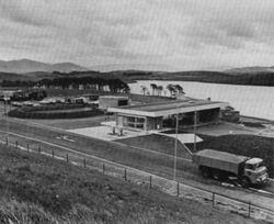
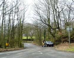
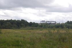
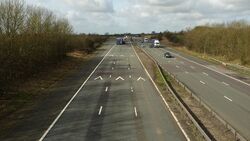
There are examples of sites reserved for new service areas all along the M6, which haven't been used and are now in varying conditions. These sites can all be matched up with the map above.
Harborough Magna
This is Stretton-under-Fosse. For Stretton-on-Fosse, see Rowborough.
The site identified at Harborough Magna (SA24; J1-2) was a huge 16 acres. The adjacent site at Corley was equally large, which goes some way to explaining why Harborough Magna was never needed.
It had four ghost slips, each of which was marked out as a full exit. The two which faced east look like they had been used to access Old Montilo Lane regularly until recently. The fields were purchased, prepared and a footbridge (with no steps up to it) was built for the eventual developer to use. It appeared in the 1974 Ordnance Survey Landranger.
In 1979 there were doubts that the service area would be built and the land was turned back into agricultural land, but on the basis that the Department of Transport would take over if they thought another service area would be required.
Before the location of this reserve service area had been identified, another site was considered at Stretton-under-Fosse. It would have required considerable earthworks to bring it into use. The name Stretton-under-Fosse continued to be used by locals to refer to the chosen reserve site, although the Department of Transport stuck with 'Harborough Magna'.
In 1995 the Department of Transport announced that they were planning to sell the unused land. The ageing footbridge was removed in 2004.
When the nearby Rugby was opened in 2021, the eastbound approach sign was placed on Harborough Magna's unused on-slip.
Doxey
Doxey services (SA6; J14-15) was planned much earlier, and its site is comparatively tiny. It totalled 10 acres, with 2 acres allocated to a maintenance compound.
The maintenance compound was built and revealed that the slip roads in and out of this service area were going to be short and sharp. Rear access was provided onto Aston Bank, but it would have had to have been removed had a service area been built.
The Ministry of Transport initially wanted to keep the land available for a future service area. The northbound side was eventually turned into a HGV checkpoint and police depot, while the southbound side has been used as project offices for various roadworks. Each side is signposted as "works unit only", attracting a degree of intrigue: nonsense internet rumours have claimed all sorts of conspiracies are happening there.
When it was finally decided that the M6 did need a new service area in the early 1990s, Doxey was immediately ruled out because it is so constrained by modern standards. The entrance to the site now has signs warning HGVs that they risk tipping over on the sharp bend, which would have been a novel feature for a service station.
Newton-le-Willows

Not to be confused with Haydock Island services on the A580.
Newton-le-Willows (SA10; J22-23) suffers from the same problem as Doxey: it was designed to the standards of 1963, and it soon became clear that these wouldn't be suitable.
The site is very close to J23, it has short slip roads, it's far too small, and shortly after it was placed on the reserve list, a school was built right next to it.
At Newton-le-Willows the land was purchased, and the main road through the service area was built, which provided rear access onto Rob Lane. A maintenance compound was built on the southbound side, which has since developed into a full National Highways regional control centre. The main part of the land isn't used.
The northbound side is used for agriculture, and the exit is only used by police and works vehicles needing to turn around.
In 1990 the Department of Transport confirmed that they didn't see this as a suitable site for a service area, having learned lessons from the problems at Knutsford. In 1995 they announced that they were going to be selling the unused land.
This site is widely referred to as "Haydock Park", and sometimes "Rob Lane", but documentation from the time used the more continental "Newton-le-Willows" (usually without the hyphens).
Broughton
Broughton (SA12; J31-32) is the interesting one.
The M6 roughly between J29 and J32 was the first motorway to open in the country. At the time, there was no such thing as a motorway service area. It stands to reason that no plan was made for Broughton services then. Yet references to it frequently crop up.
It seems that in around 1962, land was purchased for a service area at Broughton, "next to the Preston-Lancaster motorway". This suggests it was tied in to the planning of the M6 north from J32, which opened in 1965. The distance south to Charnock Richard was measured at 13 miles, fitting the pattern discussed at the top of the page.
Only one official map has ever been found, which shows a small piece of land to the north of Fernyhalgh Lane. A public footpath would have had to be diverted, a footbridge removed, and a maintenance compound would have been built on the southbound side. It would have been very close to M6 J32, but not many better options were available.
The plan was officially cancelled in 1967, with the cost of altering the land being blamed. By this stage the land allocated was far too small, and strong objections had been expected to the idea. Despite this, a government map dated 1977 said Broughton was still planned, though this may have been an oversight.
In addition, a large service area opened at Forton in 1965, removing the need for Broughton in the short term. One of the rejected proposals for Forton was an extremely large restaurant, which the Ministry believed was an underhand method of ensuring Broughton was never needed.
If there was any evidence to be found, the widening of the M6 and construction of the neighbouring industrial estate would have taken it away.
Clifton
Clifton services (SA41; J39-40) is mysterious in its own way.
As with the other service areas in Cumberland (see The Shap Shake), Clifton was expected to receive extremely low traffic levels. The land, which was owned by Lord Lonsdale, had been chosen from "limited options", and had its issues, but there were good views across the Eden Valley available.
The service area would have been twice as big as the village of Clifton, which is right next to it. Planners were therefore surprised to discover the residents, some of whom would have backed on to the service area, were rather indifferent about the idea. Developers would be offered more architectural freedom, as the backdrop was less sensitive than at the service areas to the south.
In keeping with the rest of the route, it was decided that Clifton would open as a southbound-only service area, with one brand of fuel and a very small snack bar (like Burton West), but with the potential that a northbound side could one day be developed. The motorway was built with ghost slips provided on the southbound side only, but with a tunnel running under the motorway, which is now fenced off at each end.
Lord Lonsdale was willing to sell the southbound side, and lease back the spare land that wouldn't be used yet. He wanted to keep the northbound side until it was needed. Clifton was scheduled to be opened to bids in March 1970, a few months after Tebay and Killington, with an opening date of December 1971.
It's not clear where it all went wrong. The Ministry complained about not having "financial cover" for the project, and were happy to let the other sites take priority. Once Clifton had fallen by the wayside, it was never mentioned again. The government were happy to let the other sites expand, perhaps to keep their operators happy.
Some sources refer to the site as Melkinthorpe services, but the Ministry of Transport consistently called it "Clifton". In fact they sometimes called it "Clifton (East)", which probably would have caught on, in the same way that the two northbound service areas were known as 'Burton West' and 'Tebay West'.
The land vaguely identified for Clifton northbound was finally put to use in 2025, when a temporary junction was created for a works compound, with the entry to the motorway almost exactly where the service area would have joined.
Private Proposals

Since 1992, developers have been solely responsible for coming up with their own proposals for new motorway services. This led to an increase in proposals, but they are normally clustered around the same area and most are quickly ruled out.
Under the 'Cheshire 2011' local plan (dated 1995), policy T20 allowed for a new service area in the Warrington area, which encouraged development in that area. Stafford had a similar policy.
Some of the new motorway services once planned for the M6 we have uncovered include:
| Place | Location | Proposed | Resolved | Outcome | Notes |
|---|---|---|---|---|---|
| Tebay East | J38-39 (southbound) | 1978 | 1993 | Built. | Based on DoE idea for a picnic area. Became a Private Initiative site. |
| Carnforth | J35A | 1989 | 199x | Built. | |
| J38 truckstop | J38 | 198x | 1986 | Built. | |
| Stafford (Cold Norton) | J14-15 (northbound) | 1992 | 1996 | Built. | Planned by Mobil and Agricultural & Food Research Council. |
| Stafford (Walton Heath) | J14-15 (southbound) | 1993 | 1994 | Refused. | Planned by Granada. Planning permission won, but failed to secure a signage agreement with the Highways Agency. |
| Creswell | J14A (south-west corner) | 1993 | 1994 | Refused. | Planned by Extra and Texaco for the new M6 junction which was planned at the time. Refused because it was contrary to the local plan and the new junction hadn't been built. Objections from neighbours and Trusthouse Forte. |
| Stafford (North Pirehill) | J14-15 (southbound) | 1993 | 1999 | Built. | Planned by Blue Boar and Hallam Land Management. |
| Woolston | J21 (south-east corner) | 1993 | 2001 | Refused. | Planned by Manchester Ship Canal Company (owned by Peel Group, who developed Trafford Centre). 1997 public inquiry did not comment on Woolston. Some sources said it wouldn't be signed from the M6. |
| Todhills | J44-45 | 1993 | 2008 | Signed. | Motorway service area approved but not built in 1993, though that description may be exaggerated. Instead existing site signed from new M6 in 2008. |
| Winwick (Rough Farm) | J22 (north-east corner) | 1994 | 2002 | Refused on appeal. | Planned by Bushwing Developments Ltd/Total. Apparently very large. Accessed via a new roundabout on Winwick Lane. |
| Winwick | J22 (north-west corner) | 1994 | 2002 | Refused on appeal. | Planned by Extra. Accessed via a new roundabout on Winwick Link Road. Refused at 1997 public inquiry because it's green belt land with no proven need; the junction was too busy and its internal road layout was described as "unsafe". Refused in 2001 public inquiry despite being described as "superior". Opposed by Wigan and St Helens Borough Councils, and Winwick and Croft Parish Councils. Railtrack were concerned that it would disrupt their plans to develop a freight terminal. |
| Burton-in-Kendal | J35-36 (southbound) | 1996 | 1998 | Refused. | Planned by Extra. |
| Rugby | J1 (south-west corner) | 1999 | 2005 | Refused. | Planned by Extra. Refused because it's green belt land. |
| Lymm | J20 | 2000 | 2000 | Signed. | Existing site signed from M6. |
| Catthorpe | M1/A14 interchange | 2000 | 2006 | Withdrawn. | Since 1988 there have been plans to build a new service area on the A14, and it was stated several times that this would not serve the M6. In 2005 the land was purchased by Extra's parent company, apparently having been assured that a new service area could be connected to the M1 and M6. This would fit with the Highways Agency's initial proposal of building a large roundabout here, which would have left space for a service area. The Highways Agency later changed their planned road layout to a new arrangement which left no space for a service area to be connected. |
| Rugby | J1 (north-west corner) | 2017 | 2021 | Built. | Planned by Moto. |

