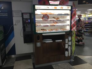
Map of Services with Krispy Kreme
Krispy Kreme
| Locations: | 92 MSAs |
| Often accompanied by: | WHSmith, Papa John's Pizza, West Cornwall Pasty Company |
| Introduced: | 2009 |
| Predecessors: | none |
| Successors: | Harry Ramsden's |
Main Page | Photo Gallery | Map
This is a map of official service areas with a Krispy Kreme outlet. Tapping each icon will reveal more details, with a link to a detailed database page.
If the map doesn't load properly, try refreshing this page.
Where an operator is given, this refers to the whole complex. Who operates each unit can get complicated, and you can normally see this by tapping the site name and scrolling to the 'contact details' section.
The colour of the icon gives you a rough idea how big the services are. Blue means motorway, green means major A-road, white means local services, black means designed for lorries. Your location, if provided, is shown in orange.

