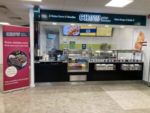
Here is a map of motorway services with a Chow outlet. Tapping each icon will reveal more details, with a link to a detailed database page.
If the map doesn't load properly, try refreshing this page. There are more search options below.
Loading map... If nothing is happening, try refreshing the page.
{"minzoom":5,"maxzoom":15,"mappingservice":"leaflet","width":"auto","height":"575px","centre":{"text":"","title":"","link":"","lat":53.917281000000002677552402019500732421875,"lon":-2.285156000000000187100113180349580943584442138671875,"icon":""},"title":"","label":"","icon":"","lines":[],"polygons":[],"circles":[],"rectangles":[],"copycoords":false,"static":false,"zoom":6,"defzoom":14,"layers":["Stamen.TonerLite","OpenStreetMap.HOT","Esri.WorldImagery","Stamen.Watercolor"],"image layers":[],"overlays":[],"resizable":true,"fullscreen":false,"scrollwheelzoom":true,"cluster":false,"clustermaxzoom":20,"clusterzoomonclick":true,"clustermaxradius":80,"clusterspiderfy":true,"geojson":"","clicktarget":"","imageLayers":[],"locations":[{"text":"\u003Cdiv class=\"mw-parser-output\"\u003E\u003Cp\u003E\u003Ca href=\"/Cherwell_Valley\" title=\"Cherwell Valley\"\u003ECherwell Valley services\u003C/a\u003E\u003Cspan\u003E\u003C/span\u003E\u003Cbr /\u003EOperated by Moto\u003Cbr /\u003E\u003Cbr /\u003EM40 at J10 and A43\n\u003C/p\u003E\u003C/div\u003E","title":"Cherwell Valley servicesOperated by MotoM40 at J10 and A43\n","link":"","lat":51.949916000000001758962753228843212127685546875,"lon":-1.1986149999999999860023081055260263383388519287109375,"icon":"/wiki/images/5/5d/Icon-MSA.png"},{"text":"\u003Cdiv class=\"mw-parser-output\"\u003E\u003Cp\u003E\u003Ca href=\"/Exeter\" title=\"Exeter\"\u003EExeter services\u003C/a\u003E\u003Cspan\u003E\u003C/span\u003E\u003Cbr /\u003EOperated by Moto\u003Cbr /\u003E\u003Cbr /\u003EM5 at J30\n\u003C/p\u003E\u003C/div\u003E","title":"Exeter servicesOperated by MotoM5 at J30\n","link":"","lat":50.7167280000000033624019124545156955718994140625,"lon":-3.463756000000000057070792536251246929168701171875,"icon":"/wiki/images/5/5d/Icon-MSA.png"},{"text":"\u003Cdiv class=\"mw-parser-output\"\u003E\u003Cp\u003E\u003Ca href=\"/Leigh_Delamere\" title=\"Leigh Delamere\"\u003ELeigh Delamere services\u003C/a\u003E\u003Cspan\u003E\u003C/span\u003E\u003Cbr /\u003EOperated by Moto\u003Cbr /\u003E\u003Cbr /\u003EM4 between J17 and J18\n\u003C/p\u003E\u003C/div\u003E","title":"Leigh Delamere servicesOperated by MotoM4 between J17 and J18\n","link":"","lat":51.5105649999999997135091689415276050567626953125,"lon":-2.158469999999999888729007579968310892581939697265625,"icon":"/wiki/images/5/5d/Icon-MSA.png"},{"text":"\u003Cdiv class=\"mw-parser-output\"\u003E\u003Cp\u003E\u003Ca href=\"/Reading\" title=\"Reading\"\u003EReading services\u003C/a\u003E\u003Cspan\u003E\u003C/span\u003E\u003Cbr /\u003EOperated by Moto\u003Cbr /\u003E\u003Cbr /\u003EM4 between J11 and J12\n\u003C/p\u003E\u003C/div\u003E","title":"Reading servicesOperated by MotoM4 between J11 and J12\n","link":"","lat":51.42442700000000144200384966097772121429443359375,"lon":-1.0347530000000000338644667863263748586177825927734375,"icon":"/wiki/images/5/5d/Icon-MSA.png"},{"text":"\u003Cdiv class=\"mw-parser-output\"\u003E\u003Cp\u003E\u003Ca href=\"/Toddington\" title=\"Toddington\"\u003EToddington services\u003C/a\u003E\u003Cspan\u003E\u003Cbr /\u003E\u003Ci\u003E(southbound only)\u003C/i\u003E\u003C/span\u003E\u003Cbr /\u003EOperated by Moto\u003Cbr /\u003E\u003Cbr /\u003EM1 between J11A and J12\n\u003C/p\u003E\u003C/div\u003E","title":"Toddington services(southbound only)Operated by MotoM1 between J11A and J12\n","link":"","lat":51.947485999999997829945641569793224334716796875,"lon":-0.50230300000000005500311317518935538828372955322265625,"icon":"/wiki/images/5/5d/Icon-MSA.png"},{"text":"\u003Cdiv class=\"mw-parser-output\"\u003E\u003Cp\u003E\u003Ca href=\"/Wetherby\" title=\"Wetherby\"\u003EWetherby services\u003C/a\u003E\u003Cspan\u003E\u003C/span\u003E\u003Cbr /\u003EOperated by Moto\u003Cbr /\u003E\u003Cbr /\u003EA1(M) at J46\n\u003C/p\u003E\u003C/div\u003E","title":"Wetherby servicesOperated by MotoA1(M) at J46\n","link":"","lat":53.94690299999999893998392508365213871002197265625,"lon":-1.3686521000000000380936171495704911649227142333984375,"icon":"/wiki/images/5/5d/Icon-MSA.png"}],"imageoverlays":null}
The colour of the icon gives you a rough idea how big the services are. Blue means motorway, green means major A-road, white means local services, black means designed for lorries.
Use any of these boxes to add more search criteria, and to show which service station with a Chow is nearest to you.
It's best to start by using just one of the drop-down boxes - you can use another if you get too many results.