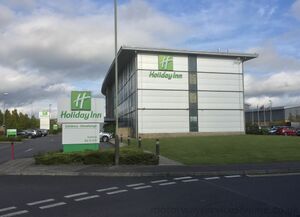
This is a map of official service areas with a Holiday Inn hotel. Tapping each icon will reveal more details, with a link to a detailed database page.
If the map doesn't load properly, try refreshing this page. There are more search options below.
Loading map... If nothing is happening, try refreshing the page.
{"minzoom":5,"maxzoom":15,"mappingservice":"leaflet","width":"auto","height":"575px","centre":{"text":"","title":"","link":"","lat":53.917281000000002677552402019500732421875,"lon":-2.285156000000000187100113180349580943584442138671875,"icon":""},"title":"","label":"","icon":"","lines":[],"polygons":[],"circles":[],"rectangles":[],"copycoords":false,"static":false,"zoom":6,"defzoom":14,"layers":["OpenStreetMap.DE"],"image layers":[],"overlays":[],"resizable":true,"fullscreen":false,"scrollwheelzoom":true,"cluster":false,"clustermaxzoom":20,"clusterzoomonclick":true,"clustermaxradius":80,"clusterspiderfy":true,"geojson":"","clicktarget":"","imageLayers":[],"locations":[{"text":"\u003Cdiv class=\"mw-parser-output\"\u003E\u003Cp\u003E\u003Ca href=\"/Peartree\" title=\"Peartree\"\u003EPeartree services\u003C/a\u003E\u003Cspan\u003E\u003C/span\u003E\u003Cbr /\u003EOperated by Welcome Break\u003Cbr /\u003Eno HGVs\u003Cbr /\u003E\u003Cbr /\u003EA34 on the Oxford Ring Road\n\u003C/p\u003E\u003C/div\u003E","title":"Peartree servicesOperated by Welcome Breakno HGVsA34 on the Oxford Ring Road\n","link":"","lat":51.7940650000000033514879760332405567169189453125,"lon":-1.284153199999999994673771652742289006710052490234375,"icon":"/wiki/images/b/b9/Icon-TRSA.png"},{"text":"\u003Cdiv class=\"mw-parser-output\"\u003E\u003Cp\u003E\u003Ca href=\"/Farlington\" title=\"Farlington\"\u003EFarlington services\u003C/a\u003E\u003Cspan\u003E\u003C/span\u003E\u003Cbr /\u003EOperated by Shell\u003Cbr /\u003EHGV access: fuel only\u003Cbr /\u003E\u003Cbr /\u003EA27 at Portsmouth\n\u003C/p\u003E\u003C/div\u003E","title":"Farlington servicesOperated by ShellHGV access: fuel onlyA27 at Portsmouth\n","link":"","lat":50.8363370000000003301465767435729503631591796875,"lon":-1.0422032000000001072947952707181684672832489013671875,"icon":"/wiki/images/b/b9/Icon-TRSA.png"},{"text":"\u003Cdiv class=\"mw-parser-output\"\u003E\u003Cp\u003E\u003Ca href=\"/Harbledown\" title=\"Harbledown\"\u003EHarbledown services\u003C/a\u003E\u003Cspan\u003E\u003Cbr /\u003E\u003Ci\u003E(eastbound only)\u003C/i\u003E\u003C/span\u003E\u003Cbr /\u003EHGV access: fuel only\u003Cbr /\u003E\u003Cbr /\u003EA2 eastbound between the M2 and Canterbury\n\u003C/p\u003E\u003C/div\u003E","title":"Harbledown services(eastbound only)HGV access: fuel onlyA2 eastbound between the M2 and Canterbury\n","link":"","lat":51.28783899999999817964635440148413181304931640625,"lon":1.01130809999999993209485182887874543666839599609375,"icon":"/wiki/images/b/b9/Icon-TRSA.png"},{"text":"\u003Cdiv class=\"mw-parser-output\"\u003E\u003Cp\u003E\u003Ca href=\"/Cornwall\" title=\"Cornwall\"\u003ECornwall services\u003C/a\u003E\u003Cspan\u003E\u003C/span\u003E\u003Cbr /\u003EOperated by Cornwall Services\u003Cbr /\u003E\u003Cbr /\u003EA30 near Roche\n\u003C/p\u003E\u003C/div\u003E","title":"Cornwall servicesOperated by Cornwall ServicesA30 near Roche\n","link":"","lat":50.42599500000000034560798667371273040771484375,"lon":-4.81576409999999999200781530817039310932159423828125,"icon":"/wiki/images/b/b9/Icon-TRSA.png"},{"text":"\u003Cdiv class=\"mw-parser-output\"\u003E\u003Cp\u003E\u003Ca href=\"/Stansted\" title=\"Stansted\"\u003EStansted services\u003C/a\u003E\u003Cspan\u003E\u003C/span\u003E\u003Cbr /\u003EHGV access: fuel only\u003Cbr /\u003E\u003Cbr /\u003EA120 between the M11 and Braintree\n\u003C/p\u003E\u003C/div\u003E","title":"Stansted servicesHGV access: fuel onlyA120 between the M11 and Braintree\n","link":"","lat":51.8755919999999974834281601943075656890869140625,"lon":0.2478052699999999941571360295711201615631580352783203125,"icon":"/wiki/images/b/b9/Icon-TRSA.png"},{"text":"\u003Cdiv class=\"mw-parser-output\"\u003E\u003Cp\u003E\u003Ca href=\"/Bedford\" title=\"Bedford\"\u003EBedford services\u003C/a\u003E\u003Cspan\u003E\u003C/span\u003E\u003Cbr /\u003EHGV access: fuel only\u003Cbr /\u003E\u003Cbr /\u003EA421 at Bedford\n\u003C/p\u003E\u003C/div\u003E","title":"Bedford servicesHGV access: fuel onlyA421 at Bedford\n","link":"","lat":52.10655100000000317095327773131430149078369140625,"lon":-0.4772749499999999756028046249412000179290771484375,"icon":"/wiki/images/b/b9/Icon-TRSA.png"},{"text":"\u003Cdiv class=\"mw-parser-output\"\u003E\u003Cp\u003E\u003Ca href=\"/Panners\" title=\"Panners\"\u003EPanners services\u003C/a\u003E\u003Cspan\u003E\u003C/span\u003E\u003Cbr /\u003EOperated by BP Express\u003Cbr /\u003EHGV access: fuel only\u003Cbr /\u003E\u003Cbr /\u003EA120 west of Braintree\n\u003C/p\u003E\u003C/div\u003E","title":"Panners servicesOperated by BP ExpressHGV access: fuel onlyA120 west of Braintree\n","link":"","lat":51.86790599999999784586179885081946849822998046875,"lon":0.5389295499999999794482619108748622238636016845703125,"icon":"/wiki/images/b/b9/Icon-TRSA.png"},{"text":"\u003Cdiv class=\"mw-parser-output\"\u003E\u003Cp\u003E\u003Ca href=\"/Gateway\" title=\"Gateway\"\u003EGateway services\u003C/a\u003E\u003Cspan\u003E\u003Cbr /\u003E\u003Ci\u003E(westbound only)\u003C/i\u003E\u003C/span\u003E\u003Cbr /\u003E\u003Cbr /\u003EA55 westbound between J33A and J33B\n\u003C/p\u003E\u003C/div\u003E","title":"Gateway services(westbound only)A55 westbound between J33A and J33B\n","link":"","lat":53.19295100000000076079231803305447101593017578125,"lon":-3.082039200000000089829654825734905898571014404296875,"icon":"/wiki/images/b/b9/Icon-TRSA.png"},{"text":"\u003Cdiv class=\"mw-parser-output\"\u003E\u003Cp\u003E\u003Ca href=\"/Solstice\" title=\"Solstice\"\u003ESolstice services\u003C/a\u003E\u003Cspan\u003E\u003C/span\u003E\u003Cbr /\u003E\u003Cbr /\u003EA303 at Amesbury\u003Cbr /\u003E\u003Cb\u003ESignposted from the road?\u003C/b\u003E Westbound only\n\u003C/p\u003E\u003C/div\u003E","title":"Solstice servicesA303 at AmesburySignposted from the road? Westbound only\n","link":"","lat":51.17746100000000097907104645855724811553955078125,"lon":-1.75659279999999995425241650082170963287353515625,"icon":"/wiki/images/b/b9/Icon-TRSA.png"},{"text":"\u003Cdiv class=\"mw-parser-output\"\u003E\u003Cp\u003E\u003Ca href=\"/Breakspear_Way\" title=\"Breakspear Way\"\u003EBreakspear Way services\u003C/a\u003E\u003Cspan\u003E\u003Cbr /\u003E\u003Ci\u003E(westbound only)\u003C/i\u003E\u003C/span\u003E\u003Cbr /\u003EOperated by BP Express and Shell\u003Cbr /\u003EHGV access: fuel only\u003Cbr /\u003E\u003Cbr /\u003EA414 west of M1 J6\n\u003C/p\u003E\u003C/div\u003E","title":"Breakspear Way services(westbound only)Operated by BP Express and ShellHGV access: fuel onlyA414 west of M1 J6\n","link":"","lat":51.75608600000000336649463861249387264251708984375,"lon":-0.4276701800000000108781250673928298056125640869140625,"icon":"/wiki/images/e/e2/Icon-APSA.png"}],"imageoverlays":null}
The colour of the icon gives you a rough idea how big the services are. Blue means motorway, green means major A-road, white means local services, black means designed for lorries.
Use any of these boxes to add more search criteria, and to show which service station with a Holiday Inn Express is nearest to you.
It's best to start by using just one of the drop-down boxes - you can use another if you get too many results.