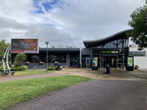
Corley services map and directions


Signposted from the road.
CV7 8NR
Two sites located between junctions, connected by an internal bridge.
Main Page | History | Location, Map & Directions
Map
🗺 Grid reference: SP308860 | Download on Google Earth | See SABRE Maps for historic maps | See GeoHack for modern layers
The map icons point to the entrance to the service area from the road. The letters refer to the direction of travel. If the site has two public entrances, both are shown, even if the second isn't well-known.
Directions
The service area is signed from both sides of the motorway between J3 and J3A.
Directions and distances are provided as a guide based on the information that was available at the time of writing. Always obey the signs and markings provided on the ground.
Get directions to Corley north-westbound:
Get directions to Corley south-eastbound:
ORNot Far From
Exhall (4 miles)
Coventry (7 miles)
Nuneaton (7 miles)
Birmingham Airport (10 miles)
N.E.C. (10 miles)
Birmingham (18 miles)