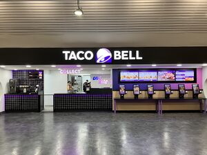
This is a map of official service areas with a Taco Bell store. Tapping each icon will reveal more details, with a link to a detailed database page.
If the map doesn't load properly, try refreshing this page. There are more search options below.
Loading map... If nothing is happening, try refreshing the page.
{"minzoom":5,"maxzoom":15,"mappingservice":"leaflet","width":"auto","height":"575px","centre":{"text":"","title":"","link":"","lat":53.917281000000002677552402019500732421875,"lon":-2.285156000000000187100113180349580943584442138671875,"icon":""},"title":"","label":"","icon":"","lines":[],"polygons":[],"circles":[],"rectangles":[],"copycoords":false,"static":false,"zoom":6,"defzoom":14,"layers":["OpenStreetMap.DE"],"image layers":[],"overlays":[],"resizable":true,"fullscreen":false,"scrollwheelzoom":true,"cluster":false,"clustermaxzoom":20,"clusterzoomonclick":true,"clustermaxradius":80,"clusterspiderfy":true,"geojson":"","clicktarget":"","imageLayers":[],"locations":[{"text":"\u003Cdiv class=\"mw-parser-output\"\u003E\u003Cp\u003E\u003Ca href=\"/Birchanger_Green\" title=\"Birchanger Green\"\u003EBirchanger Green services\u003C/a\u003E\u003Cbr /\u003EOperated by Welcome Break\u003Cbr /\u003E\u003Cbr /\u003EM11 at J8\n\u003C/p\u003E\u003C/div\u003E","title":"Birchanger Green servicesOperated by Welcome BreakM11 at J8\n","link":"","lat":51.8713589999999982182998792268335819244384765625,"lon":0.1951090000000000046487258487104554660618305206298828125,"icon":"/wiki/images/5/5d/Icon-MSA.png"},{"text":"\u003Cdiv class=\"mw-parser-output\"\u003E\u003Cp\u003E\u003Ca href=\"/Leicester_Forest_East\" title=\"Leicester Forest East\"\u003ELeicester Forest East services\u003C/a\u003E\u003Cbr /\u003EOperated by Welcome Break\u003Cbr /\u003E\u003Cbr /\u003EM1 between J21 and J21A\n\u003C/p\u003E\u003C/div\u003E","title":"Leicester Forest East servicesOperated by Welcome BreakM1 between J21 and J21A\n","link":"","lat":52.61913299999999793499227962456643581390380859375,"lon":-1.205664000000000068979488787590526044368743896484375,"icon":"/wiki/images/5/5d/Icon-MSA.png"},{"text":"\u003Cdiv class=\"mw-parser-output\"\u003E\u003Cp\u003E\u003Ca href=\"/South_Mimms\" title=\"South Mimms\"\u003ESouth Mimms services\u003C/a\u003E\u003Cbr /\u003EOperated by Welcome Break\u003Cbr /\u003EHGV access: truckstop only\u003Cbr /\u003E\u003Cbr /\u003EM25 at J23 and A1(M) at J1\n\u003C/p\u003E\u003C/div\u003E","title":"South Mimms servicesOperated by Welcome BreakHGV access: truckstop onlyM25 at J23 and A1(M) at J1\n","link":"","lat":51.68740799999999779856807435862720012664794921875,"lon":-0.221855999999999997651656258312868885695934295654296875,"icon":"/wiki/images/5/5d/Icon-MSA.png"},{"text":"\u003Cdiv class=\"mw-parser-output\"\u003E\u003Cp\u003E\u003Ca href=\"/Folkestone\" title=\"Folkestone\"\u003EFolkestone services\u003C/a\u003E\u003Cbr /\u003EOperated by Stop 24\u003Cbr /\u003E\u003Cbr /\u003EM20 at J11\n\u003C/p\u003E\u003C/div\u003E","title":"Folkestone servicesOperated by Stop 24M20 at J11\n","link":"","lat":51.09491100000000329828253597952425479888916015625,"lon":1.04446599999999989449861459434032440185546875,"icon":"/wiki/images/5/5d/Icon-MSA.png"},{"text":"\u003Cdiv class=\"mw-parser-output\"\u003E\u003Cp\u003E\u003Ca href=\"/Cornwall\" title=\"Cornwall\"\u003ECornwall services\u003C/a\u003E\u003Cbr /\u003EOperated by Cornwall Services\u003Cbr /\u003E\u003Cbr /\u003EA30 near Roche\n\u003C/p\u003E\u003C/div\u003E","title":"Cornwall servicesOperated by Cornwall ServicesA30 near Roche\n","link":"","lat":50.42599500000000034560798667371273040771484375,"lon":-4.81576409999999999200781530817039310932159423828125,"icon":"/wiki/images/b/b9/Icon-TRSA.png"},{"text":"\u003Cdiv class=\"mw-parser-output\"\u003E\u003Cp\u003E\u003Ca href=\"/Solstice\" title=\"Solstice\"\u003ESolstice services\u003C/a\u003E\u003Cbr /\u003E\u003Cspan\u003E\u003Ci\u003E(available westbound only)\u003C/i\u003E\u003C/span\u003E\u003Cbr /\u003E\u003Cbr /\u003EOperated by Asda\u003Cbr /\u003E\u003Cbr /\u003EA303 at Amesbury\u003Cbr /\u003E\u003Cb\u003ESignposted from the road?\u003C/b\u003E Westbound only\n\u003C/p\u003E\u003C/div\u003E","title":"Solstice services(available westbound only)Operated by AsdaA303 at AmesburySignposted from the road? Westbound only\n","link":"","lat":51.17746100000000097907104645855724811553955078125,"lon":-1.75659279999999995425241650082170963287353515625,"icon":"/wiki/images/b/b9/Icon-TRSA.png"},{"text":"\u003Cdiv class=\"mw-parser-output\"\u003E\u003Cp\u003E\u003Ca href=\"/Spalding\" title=\"Spalding\"\u003ESpalding services\u003C/a\u003E\u003Cbr /\u003EOperated by Welcome Break\u003Cbr /\u003Eno HGVs\u003Cbr /\u003E\u003Cbr /\u003EA16/A1175 near Spalding\n\u003C/p\u003E\u003C/div\u003E","title":"Spalding servicesOperated by Welcome Breakno HGVsA16/A1175 near Spalding\n","link":"","lat":52.76092100000000328918758896179497241973876953125,"lon":-0.1585950000000000137401201527609373442828655242919921875,"icon":"/wiki/images/b/b9/Icon-TRSA.png"}],"imageoverlays":null}
Where an operator is given, this refers to the whole complex. Who operates each unit can get complicated, and you can normally see this by tapping the site name and scrolling to the 'contact details' section.
The colour of the icon gives you a rough idea how big the services are. Blue means motorway, green means major A-road, white means local services, black means designed for lorries.
Use any of these boxes to add more search criteria, and to show which service station with a Taco Bell is nearest to you.
It's best to start by using just one of the drop-down boxes - you can use another if you get too many results.