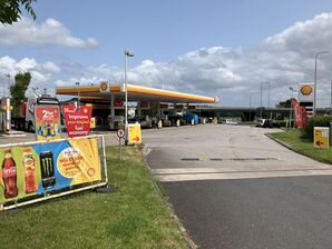
Haydock Island services map and directions


Signposted from the road? eastbound only
WA12 0HL
Single site located between junctions on one side of the road.
Main Page | Photo Gallery | Location, Map & Directions
Map
🗺 Grid reference: SJ579974 | Download on Google Earth | See SABRE Maps for historic maps | See GeoHack for modern layers
The map icons point to the entrance to the service area from the road. The letters refer to the direction of travel. If the site has two public entrances, both are shown, even if the second isn't well-known.
Directions
The service area is signed from the eastbound side of the A580, immediately before the M6.
Access from the westbound side, and from the M6, is possible, but not signposted. You would need to follow signs for the M6 north from the J23 roundabout. The entrance to the service area is on the left, immediately before joining the M6.
Directions and distances are provided as a guide based on the information that was available at the time of writing. Always obey the signs and markings provided on the ground.
Get directions to Haydock Island westbound:
Get directions to Haydock Island eastbound:
ORNot Far From
Old Boston Trading Estate (1 mile)
Ashton-in-Markerfield (1 mile)
Haydock Park (1 mile)
Newton-le-Willows (2 miles)
St Helens (5 miles)
Wigan (6 miles)
Warrington (7 miles)
Knowsley Safari Park (11 miles)
Manchester (18 miles)
Liverpool (20 miles)